401 Prairie Hawk Dr Castle Rock, CO
Confluence Companies
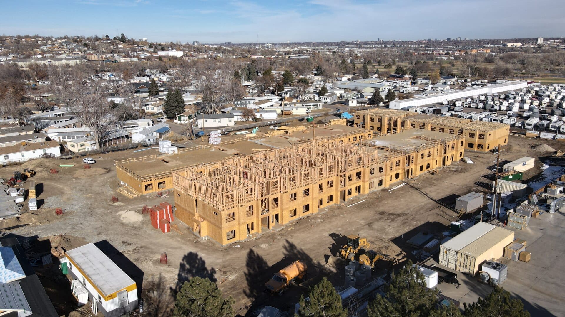
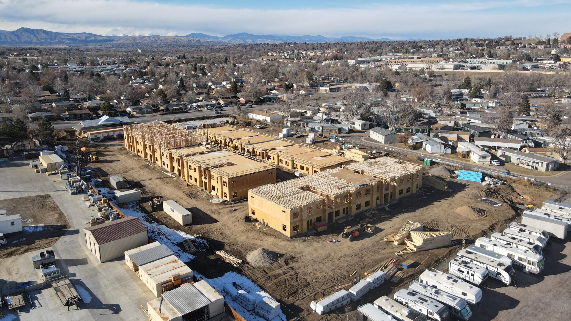
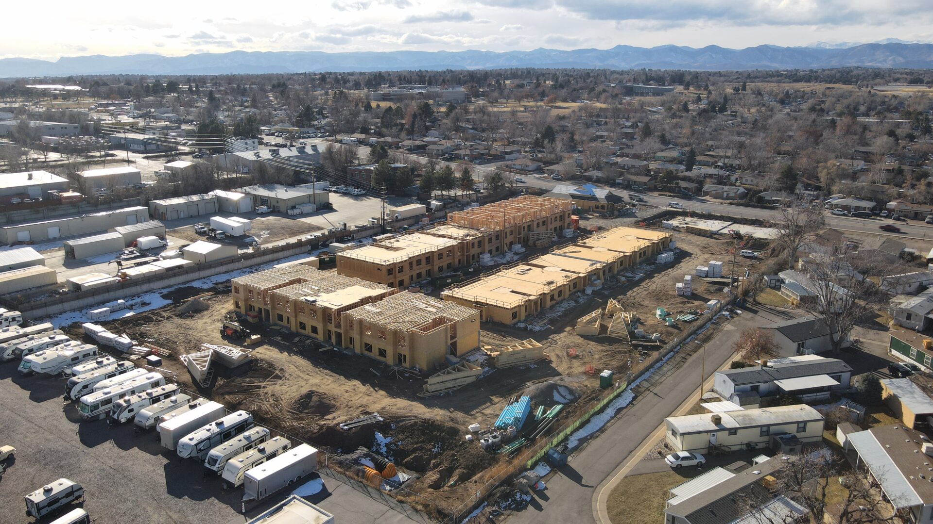
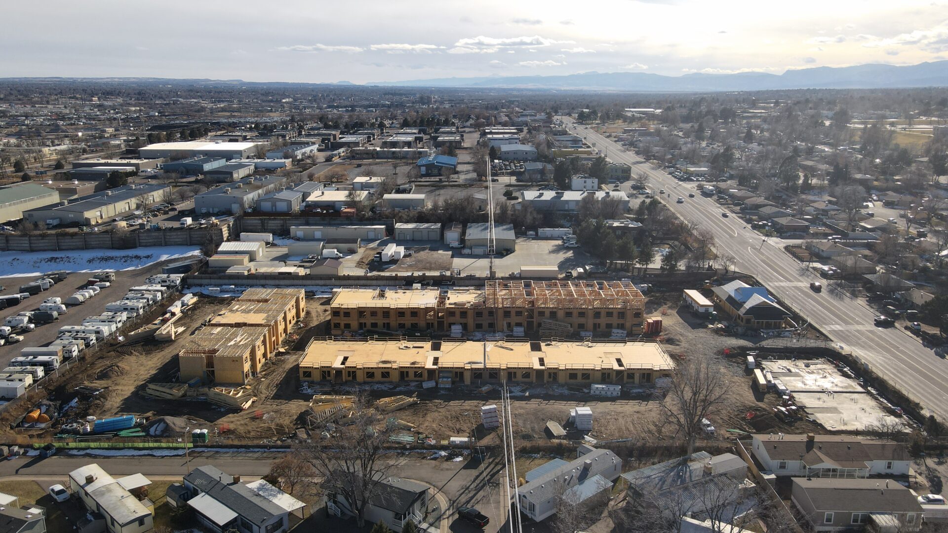
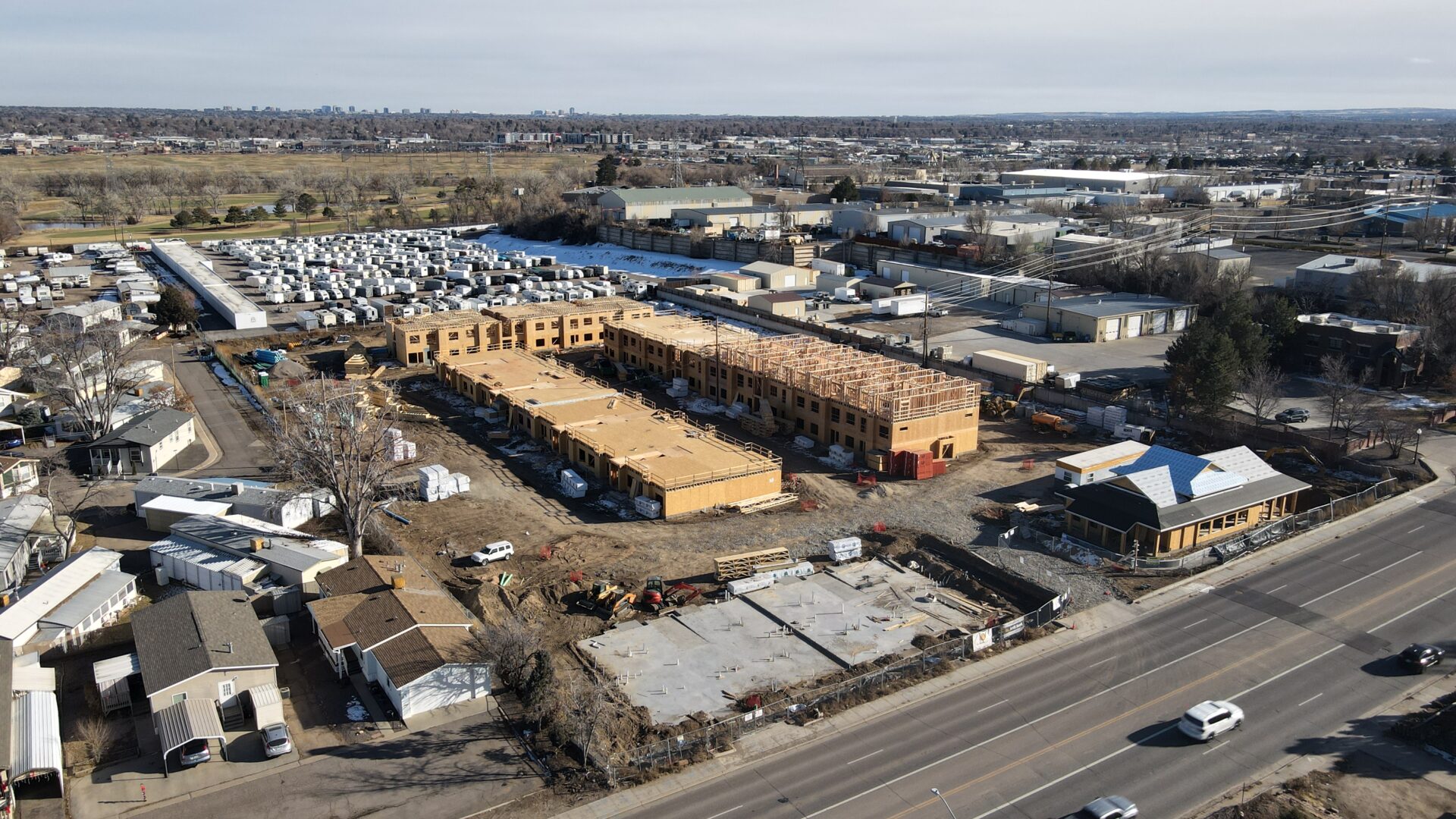
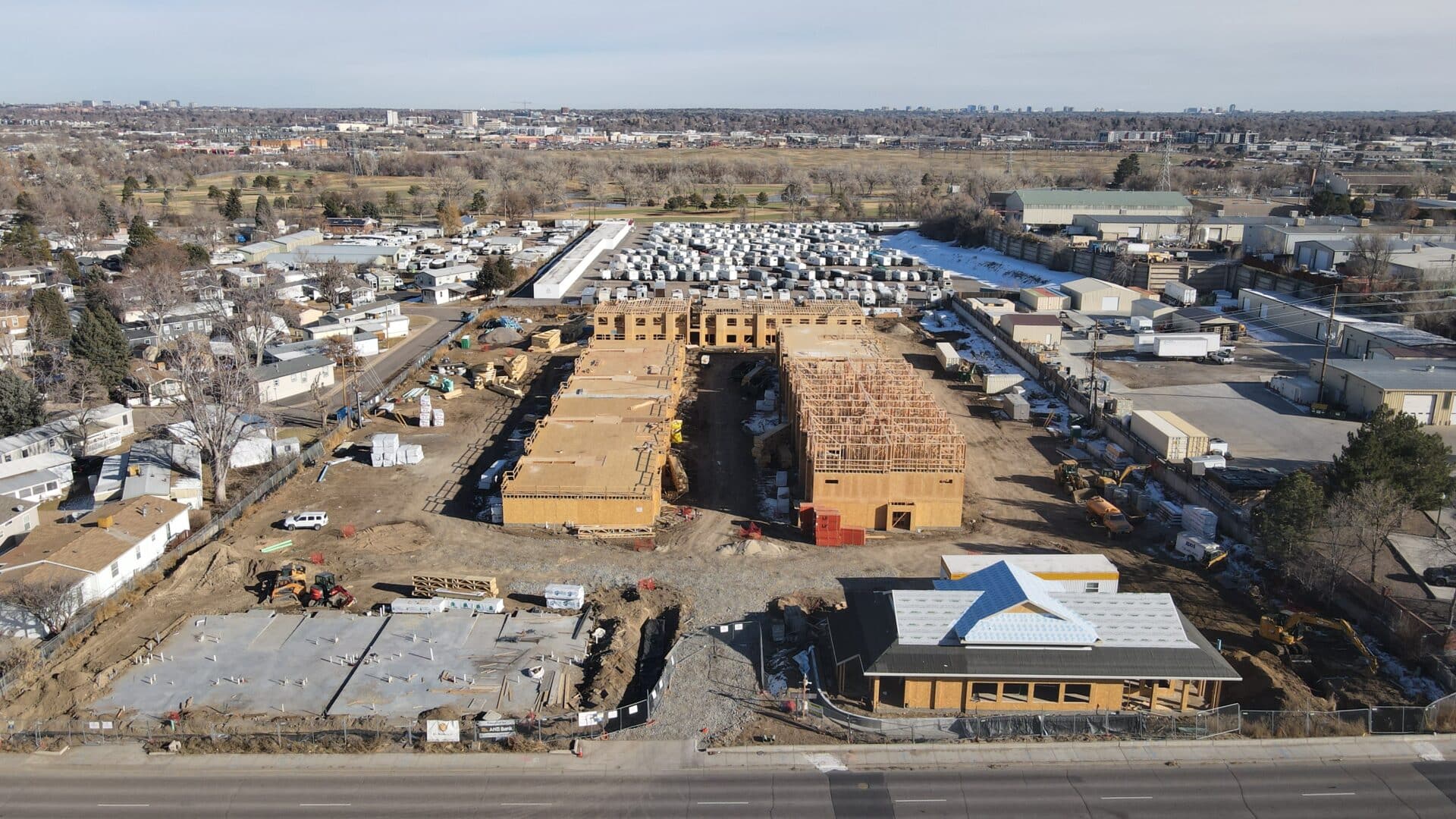
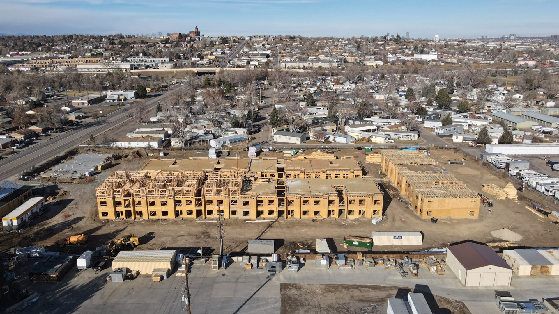
Commercial Drone Photos

Commercial Drone Videos
Key Advantages:
Accurate and Detailed Monitoring: Drones can capture high-resolution images from various angles, providing an accurate and detailed view of the construction site. This allows project managers to closely monitor the progress, identify potential issues, and make informed decisions based on real-time data.
Cost and Time Savings: Drones can quickly survey large areas in a short amount of time, reducing the need for manual inspections, which can be time-consuming and costly. The rapid data collection helps in timely decision-making, preventing delays and reducing overall project duration.
Improved Safety: Drones can access difficult-to-reach or hazardous areas, eliminating the need for workers to physically inspect those locations. This helps in reducing on-site accidents and ensures worker safety.
Enhanced Communication and Collaboration: Drone photos provide a visual representation of the construction progress, making it easier to communicate the status of the project to stakeholders, clients, and team members. This visual aid fosters better collaboration and understanding among all parties involved.
Documentation and Record-Keeping: Drone photos create a chronological record of the construction site over time. These records can serve as valuable documentation for future reference, dispute resolution, insurance purposes, or for compliance with regulatory requirements.
Quality Control and Issue Detection: By comparing drone images with construction plans and 3D models, project managers can identify discrepancies early on, enabling timely corrections and ensuring that the construction aligns with the design intent.
Progress Reporting: Drones can be programmed to take regular photos at specific intervals, allowing for systematic progress reporting. This feature enables stakeholders to track the project's development over time and measure it against predefined milestones.
Improved Planning and Resource Management: Analyzing drone data helps in optimizing resource allocation and scheduling. Project managers can identify areas of concern, allocate resources efficiently, and adjust construction timelines accordingly.
Integration with BIM and GIS: Drone data can be integrated with Building Information Modeling (BIM) and Geographic Information System (GIS) platforms. This integration offers a comprehensive view of the construction site and enhances the overall project management capabilities.
Environmental Impact Assessment: Drones can capture images of the construction site and its surroundings, aiding in environmental impact assessments. This data helps in understanding the project's effects on the environment and supports sustainable construction practices.
Overall, using drone photos for construction progression offers a powerful tool to enhance efficiency, safety, and communication throughout the construction project lifecycle. It allows construction teams to make data-driven decisions, reduce costs, and deliver projects more effectively.
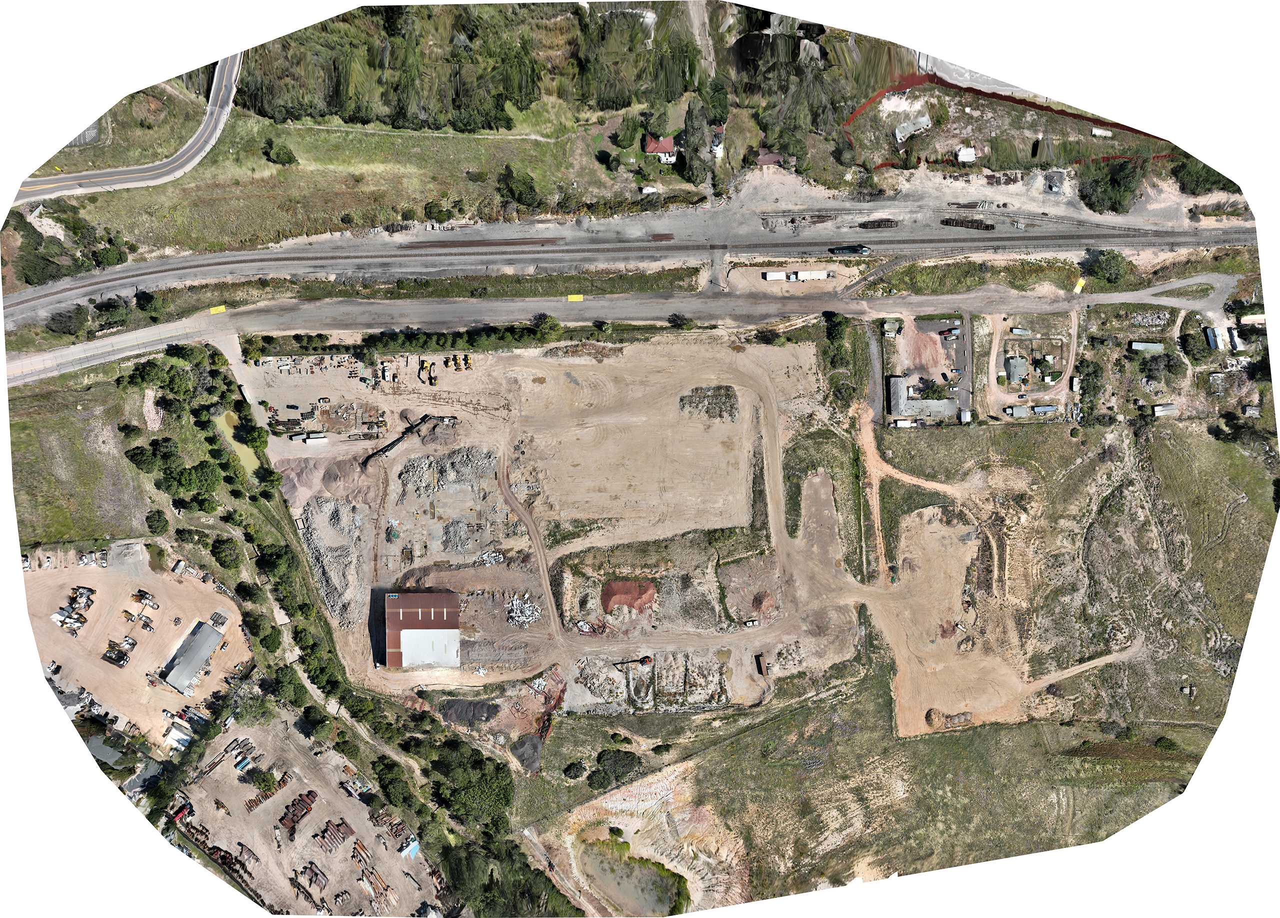
Orthomosaic Map
Advantages over traditional aerial photography or satellite imagery are:
- High Resolution: Drones can capture images at a much higher resolution than satellites, resulting in more detailed maps.
- Flexibility: Drones can fly at lower altitudes and capture imagery on-demand, making them ideal for smaller areas or areas with specific requirements.
- Timeliness: Data can be processed quickly, providing near real-time information for time-sensitive projects or monitoring.
- Cost-Effectiveness: Compared to manned aircraft or satellite imagery, drones offer a cost-effective solution for generating high-quality orthomosaic maps.
Overall, orthomosaic maps are valuable tools for visualizing and analyzing large areas with high precision, making them indispensable in many industries for planning, decision-making, and resource management.
3D Model
Modeling Process:
Image Acquisition: A drone captures a series of overlapping images while flying over the area of interest. These images provide different perspectives of the subject, allowing for the reconstruction of its 3D structure.
Feature Extraction: Specialized photogrammetry software processes the collected images. It identifies common points and unique features visible in multiple images and triangulates their 3D positions.
Point Cloud Generation: The software creates a point cloud, which is a dense collection of 3D points representing the surface of the subject.
Mesh Generation: The point cloud is then used to create a mesh, which is a connected network of triangles that forms a 3D representation of the object or terrain.
Texture Mapping: The original images are projected onto the mesh, adding realistic textures and colors to the 3D model.
Standard Use:
Construction and Architecture: 3D models of construction sites or buildings can be created and used for planning, design, and progress monitoring. Architects and engineers can gain valuable insights into the construction process and identify potential issues before they arise.
Surveying and Mapping: Drones equipped with photogrammetric capabilities can quickly and accurately map large areas of land, creating detailed topographic maps. These maps can be used for urban planning, land management, and environmental monitoring.
Infrastructure Inspection: 3D models generated with drones can be used to inspect bridges, power lines, and other infrastructure. Engineers can remotely assess structural integrity and plan maintenance activities.
