Construction Drone Services —
Mapping, Surveying, and Inspections
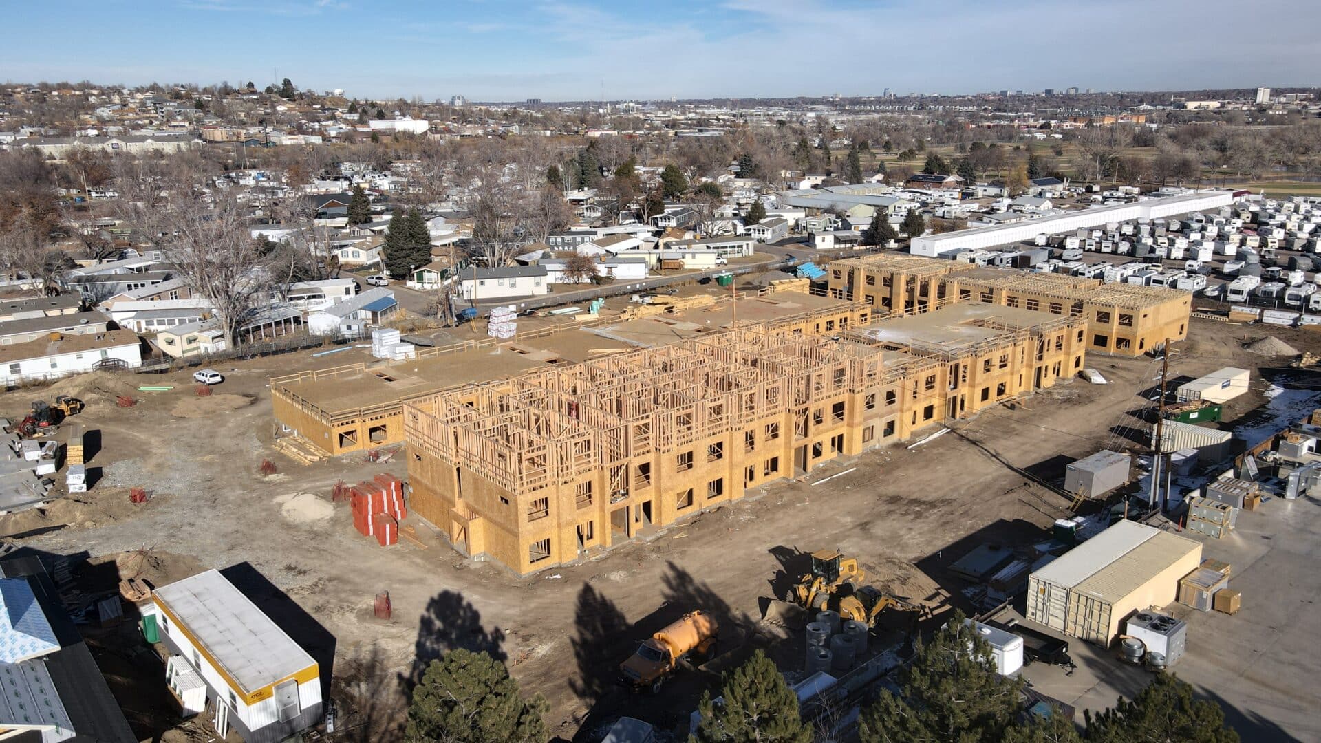
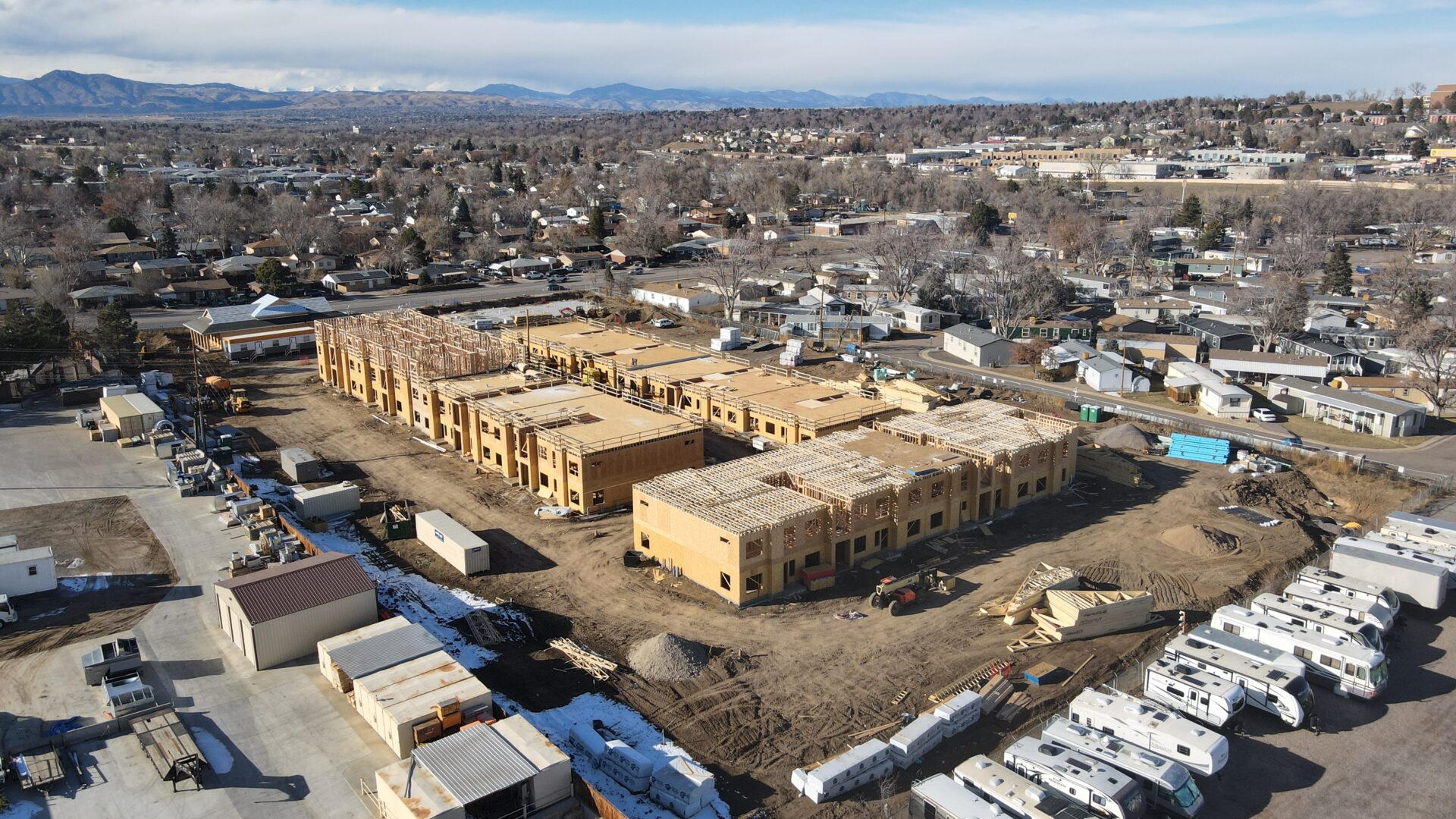
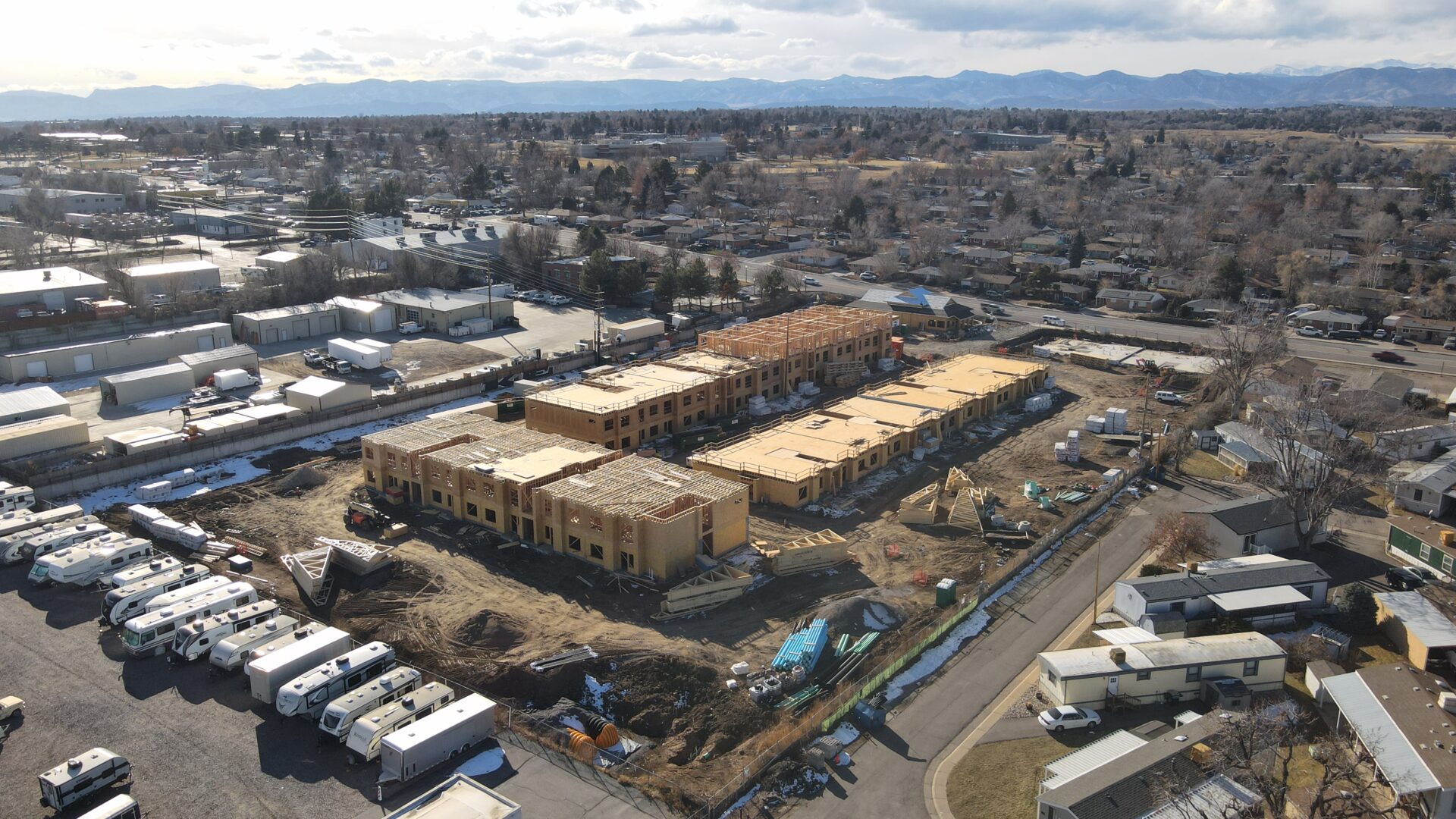
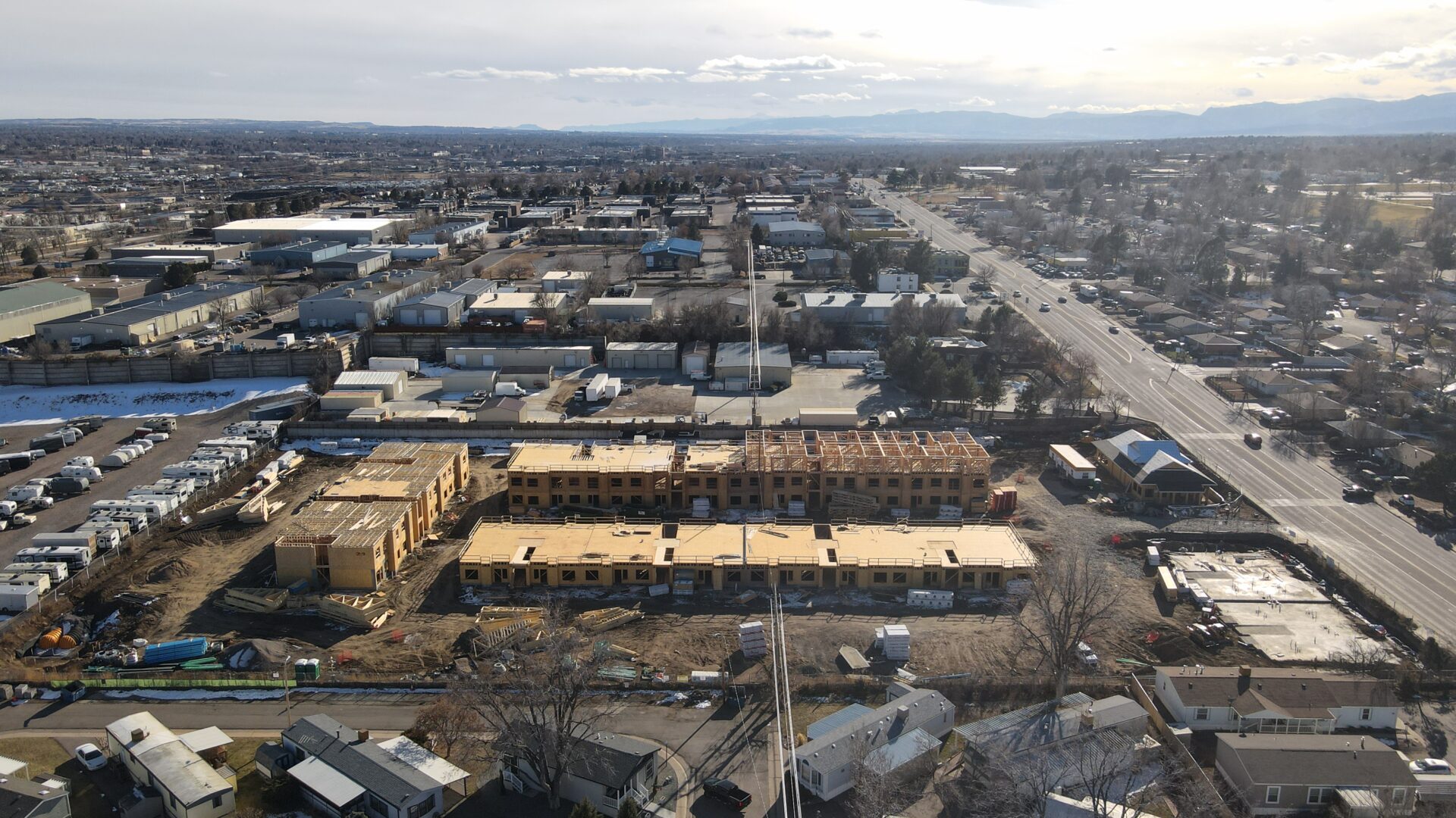
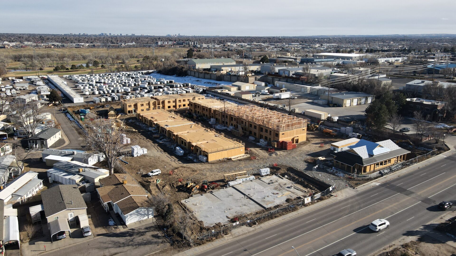
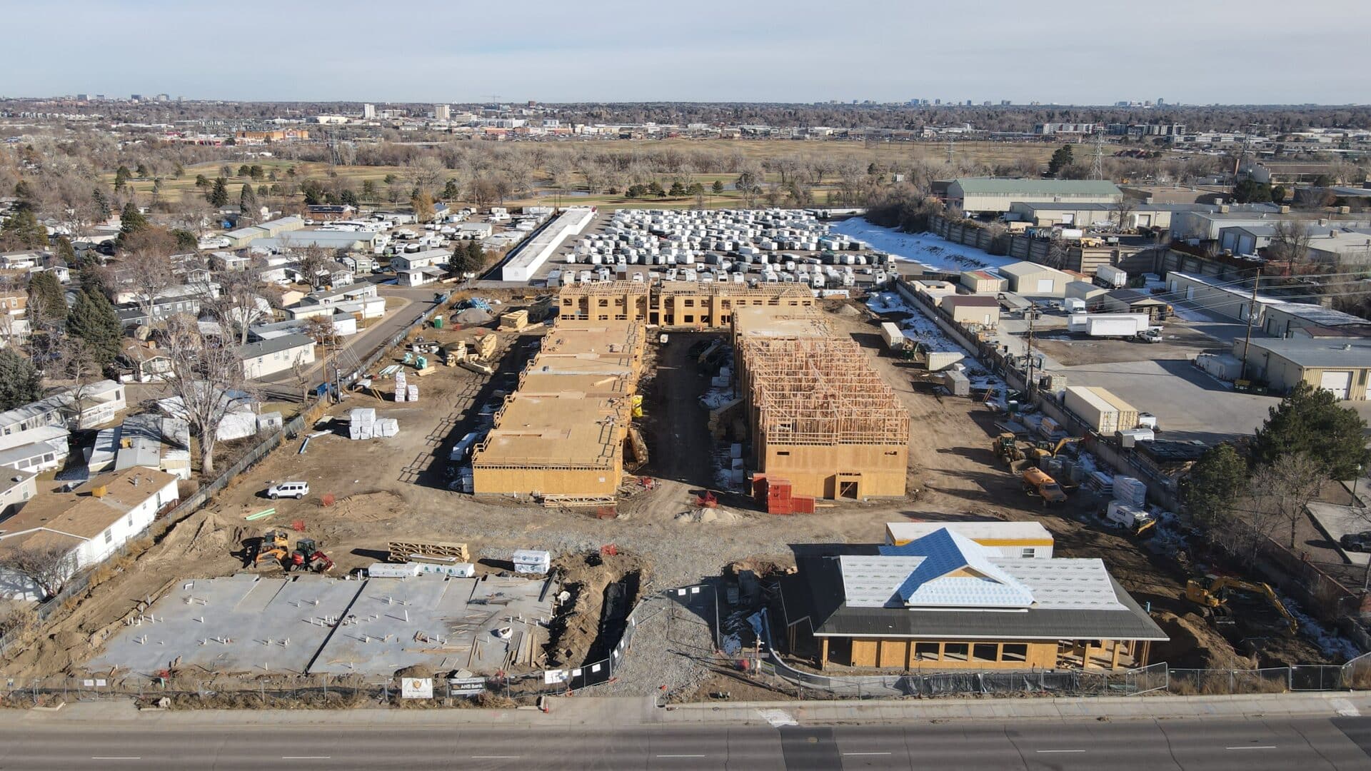
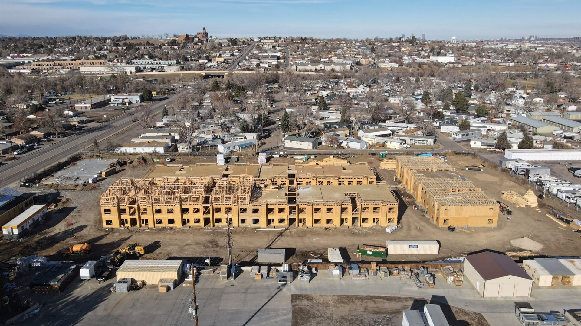
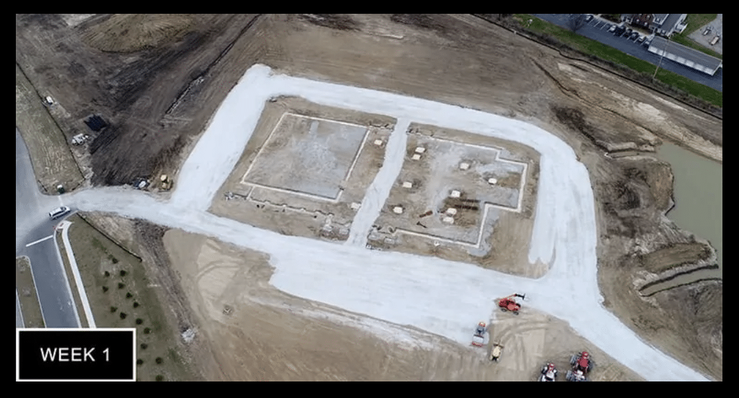
Document Your Construction Project Every Step of the Way

Construction Drone Services We Offer
Advantages over traditional aerial photography or satellite imagery are:
- High Resolution: Drones can capture images at a much higher resolution than satellites, resulting in more detailed maps.
- Flexibility: Drones can fly at lower altitudes and capture imagery on-demand, making them ideal for smaller areas or areas with specific requirements.
- Timeliness: Data can be processed quickly, providing near real-time information for time-sensitive projects or monitoring.
- Cost-Effectiveness: Compared to manned aircraft or satellite imagery, drones offer a cost-effective solution for generating high-quality orthomosaic maps.
Overall, orthomosaic maps are valuable tools for visualizing and analyzing large areas with high precision, making them indispensable in many industries for planning, decision-making, and resource management.
Modeling Process:
Image Acquisition: A drone captures a series of overlapping images while flying over the area of interest. These images provide different perspectives of the subject, allowing for the reconstruction of its 3D structure.
Feature Extraction: Specialized photogrammetry software processes the collected images. It identifies common points and unique features visible in multiple images and triangulates their 3D positions.
Point Cloud Generation: The software creates a point cloud, which is a dense collection of 3D points representing the surface of the subject.
Mesh Generation: The point cloud is then used to create a mesh, which is a connected network of triangles that forms a 3D representation of the object or terrain.
Texture Mapping: The original images are projected onto the mesh, adding realistic textures and colors to the 3D model.
Standard Use:
Construction and Architecture: 3D models of construction sites or buildings can be created and used for planning, design, and progress monitoring. Architects and engineers can gain valuable insights into the construction process and identify potential issues before they arise.
Surveying and Mapping: Drones equipped with photogrammetric capabilities can quickly and accurately map large areas of land, creating detailed topographic maps. These maps can be used for urban planning, land management, and environmental monitoring.
Infrastructure Inspection: 3D models generated with drones can be used to inspect bridges, power lines, and other infrastructure. Engineers can remotely assess structural integrity and plan maintenance activities.
Key Advantages:
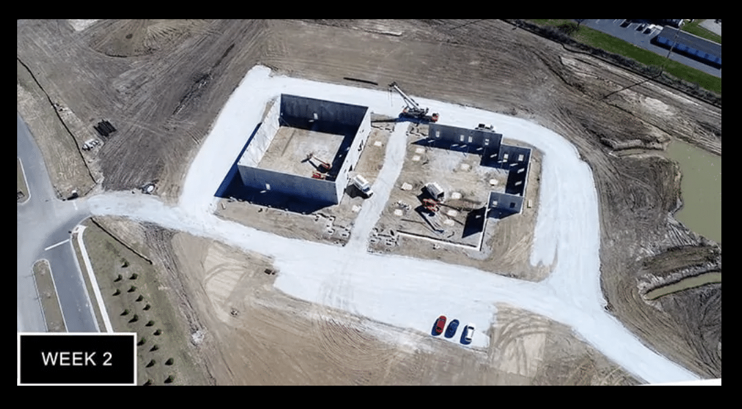
Accurate and Detailed Monitoring: Drones can capture high-resolution images from various angles, providing an accurate and detailed view of the construction site. This allows project managers to closely monitor the progress, identify potential issues, and make informed decisions based on real-time data.
Cost and Time Savings: Drones can quickly survey large areas in a short amount of time, reducing the need for manual inspections, which can be time-consuming and costly. The rapid data collection helps in timely decision-making, preventing delays and reducing overall project duration.
Improved Safety: Drones can access difficult-to-reach or hazardous areas, eliminating the need for workers to physically inspect those locations. This helps in reducing on-site accidents and ensures worker safety.
Enhanced Communication and Collaboration: Drone photos provide a visual representation of the construction progress, making it easier to communicate the status of the project to stakeholders, clients, and team members. This visual aid fosters better collaboration and understanding among all parties involved.
Documentation and Record-Keeping: Drone photos create a chronological record of the construction site over time. These records can serve as valuable documentation for future reference, dispute resolution, insurance purposes, or for compliance with regulatory requirements.
Quality Control and Issue Detection: By comparing drone images with construction plans and 3D models, project managers can identify discrepancies early on, enabling timely corrections and ensuring that the construction aligns with the design intent.
Progress Reporting: Drones can be programmed to take regular photos at specific intervals, allowing for systematic progress reporting. This feature enables stakeholders to track the project's development over time and measure it against predefined milestones.
Improved Planning and Resource Management: Analyzing drone data helps in optimizing resource allocation and scheduling. Project managers can identify areas of concern, allocate resources efficiently, and adjust construction timelines accordingly.
Integration with BIM and GIS: Drone data can be integrated with Building Information Modeling (BIM) and Geographic Information System (GIS) platforms. This integration offers a comprehensive view of the construction site and enhances the overall project management capabilities.
Environmental Impact Assessment: Drones can capture images of the construction site and its surroundings, aiding in environmental impact assessments. This data helps in understanding the project's effects on the environment and supports sustainable construction practices.
Overall, using drone photos for construction progression offers a powerful tool to enhance efficiency, safety, and communication throughout the construction project lifecycle. It allows construction teams to make data-driven decisions, reduce costs, and deliver projects more effectively.
Standard Use:
Visual Progress Tracking: Drone videos can be used to create time-lapse footage, showing the construction site's evolution over days, weeks, or months. This provides an easy-to-understand visual representation of the project's progress, making it simple for stakeholders to assess how the construction is advancing.
Site Inspections: Drone videos enable detailed site inspections from various angles, heights, and perspectives. Project managers can use this footage to identify potential issues, safety hazards, or deviations from plans without the need for physical presence on the site.
Safety Monitoring: Drones equipped with video cameras can monitor the construction site in real-time, allowing safety officers to identify unsafe practices or conditions. This proactive approach enhances on-site safety and minimizes accidents.
Quality Assurance: Drone videos can assist in quality control by comparing the as-built conditions with design plans. This helps identify discrepancies or deficiencies early on, facilitating prompt corrective action.
Stakeholder Communication: Shareable drone video footage enhances communication with clients, investors, and other stakeholders. Instead of relying on technical reports or drawings, a video provides a clear and engaging update on the project's status and direction.
Conflict Resolution: In case of disputes or disagreements, drone videos can serve as objective evidence to resolve conflicts regarding the project's execution or adherence to contractual agreements.
Workflow Analysis: Observing drone footage of construction activities can help project managers analyze workflow efficiency. They can identify bottlenecks, process improvements, and areas where productivity can be enhanced.
Marketing and Documentation: High-quality drone videos can be used for marketing purposes, showcasing completed or ongoing projects to potential clients or investors. Additionally, videos serve as part of the project's historical documentation.
Environmental Impact Assessment: Drones equipped with thermal cameras or multispectral sensors can capture valuable data for environmental impact assessments. This information aids in monitoring changes to the site and surrounding areas, especially in environmentally sensitive projects.
Remote Project Management: For construction projects in remote or challenging terrains, drone videos offer an effective means of remotely managing and supervising progress.
As-Built Documentation: As the project nears completion, drone videos can be used to create comprehensive as-built documentation, capturing the final state of the construction for future reference or maintenance purposes.
Drone video footage provides a versatile and comprehensive toolset for construction
progression, enabling better decision-making, improved communication, and enhanced
project management capabilities throughout the construction lifecycle.
DISCLAIMER:
WE DO NOT PERFORM SURVEY GRADE WORK
While Boxwood Photos is capable of aerial data collection, visitors should know that we do not interpret survey grade information. For projects where exact measurements count, you still need to rely on a licensed land surveyor or survey engineer. Boxwood Photos can provide data in cooperation with your surveyor, but our data gathering does not replace the need for a licensed land surveyor in any state. This is not exclusive to our business, all drone data collection services cannot interpret data unless they have a surveyor on staff. Additionally, we do not overlay property boundaries on home lots (developed or undeveloped) for sale for the same reasons noted above.
Here are some key advantages:
- Time Efficiency:
- Drones can quickly survey large construction sites and stockpile areas, significantly reducing the time required for data collection compared to traditional methods.
- Rapid data acquisition allows for frequent updates, providing real-time information on stockpile volumes and changes over time.
- Cost-Effectiveness:
- Drone surveys are generally more cost-effective than traditional survey methods, such as ground-based surveys or manned aircraft flights.
- Reduced survey time and labor costs contribute to overall project savings.
- Improved Safety:
- Drones eliminate the need for personnel to physically climb stockpiles or navigate challenging terrain, reducing the risk of accidents and injuries.
- Construction sites often have hazardous conditions, and using drones helps maintain a safer working environment.
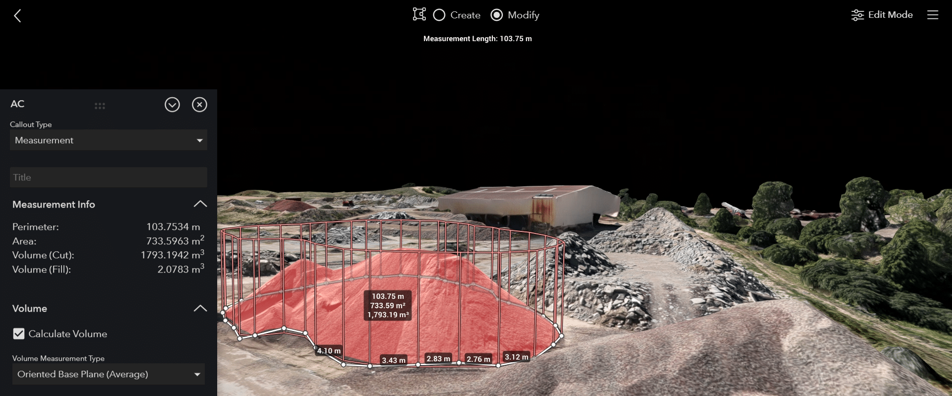
- High Precision and Accuracy:
- Photogrammetry techniques employed by drones result in highly accurate 3D models and volumetric measurements of stockpiles.
- Accurate data is crucial for precise project planning, resource allocation, and decision-making.
- Data Visualization and Analysis:
- The 3D models generated by drones provide a visual representation of the stockpile, enabling construction professionals to better understand the site's topography.
- Volumetric analysis helps in monitoring material usage, optimizing stockpile management, and identifying potential issues early in the construction process.
- Inventory Management:
- Drones facilitate regular and automated stockpile assessments, allowing construction companies to manage inventory more efficiently.
- Timely and accurate volume measurements aid in planning material logistics, reducing the risk of shortages or overstock situations.
- Project Monitoring and Reporting:
- Drones provide a reliable means of monitoring construction progress, allowing project managers to compare actual progress with project timelines and schedules.
- Reporting tools can be integrated to provide stakeholders with comprehensive and up-to-date information on stockpile volumes and overall project status.
- Environmental Compliance:
- Accurate volumetric measurements help construction companies comply with environmental regulations by ensuring that material extraction and usage align with permitted levels.
- This can be crucial for avoiding fines and maintaining a positive relationship with regulatory authorities.
- Adaptability and Accessibility:
- Drones can access difficult or dangerous terrain, providing construction teams with data from areas that might be challenging to survey using traditional methods.
- This adaptability improves the comprehensiveness of the survey and ensures that all relevant areas are included in volumetric measurements.
Overall, the integration of drones for volumetric measurements in the construction sector contributes to streamlined operations, informed decision-making, and improved project outcomes.